
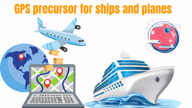
Navigation systems play a pivotal role in the maritime and aviation industries, ensuring safe and efficient transportation. Over the years, advancements in technology have transformed navigation from primitive methods to highly accurate systems.
Before the emergence of GPS (Global Positioning System), various precursor technologies paved the way for modern navigation.
Early Navigation Methods
Celestial Navigation
Utilizing the stars to determine position: Sailors and pilots relied on celestial bodies such as stars, the sun, and the moon to ascertain their location on the Earth’s surface.
Challenges and limitations: Celestial navigation required extensive knowledge of astronomy and nautical charts. Adverse weather conditions and limited visibility posed significant challenges, making accurate navigation challenging.
Dead Reckoning
Estimating position based on previously known data: Dead reckoning involved calculating the present location by using a previously known position, distance traveled, and direction taken.
Accuracy issues and reliance on human calculations: Despite its usefulness, dead reckoning suffered from cumulative errors due to inaccuracies in initial data and human calculation, resulting in potential deviations.
Radio Direction Finders (RDF)
Utilizing radio signals for navigation brought revolutionary changes to the maritime and aviation industries.
Development and implementation in ships and planes: RDF systems enabled ships and planes to use radio signals transmitted from radio beacons to determine their position relative to the beacon’s location. This innovation significantly enhanced accuracy and reduced reliance on celestial navigation.
Loran-C
Introduction to Loran-C navigation system
Loran-C emerged as a precise and reliable navigation system after World War II. It provided an alternative to celestial navigation and dead reckoning, ushering in a new era of navigation technology.
Principle and functioning of Loran-C technology
Loran-C relied on the time difference between received radio signals from multiple transmitters to calculate the position accurately. By using hyperbolic lines of position, Loran-C determined the vessel or aircraft’s location.
Advantages and drawbacks compared to previous methods
Loran-C offered superior accuracy and reduced dependence on stars and human calculations. However, its reliance on land-based transmitters limited its range and availability in certain remote areas.
Omega Navigation System
Overview of the Omega system
The Omega system revolutionized long-range navigation. It utilized very low-frequency (VLF) radio waves to triangulate positions accurately.
How Omega worked and its accuracy improvements
The concept of phase comparison allowed Omega to measure time differentials using specific VLF signals transmitted by several stations. These measurements enabled precise positioning with an accuracy of up to 2 nautical miles.
Global adoption of Omega and limitations faced
Omega gained popularity worldwide due to its accuracy and wide coverage. However, its limited number of stations and vulnerability to atmospheric conditions compromised its reliability in certain areas.
Inertial Navigation System (INS)
Introduction to INS technology
INS offered an innovative approach to navigation by utilizing internal sensors and computational algorithms. It reduced dependence on external signals and opened up possibilities for accurate navigation in remote areas.
Working principles and components
INS measured changes in velocity and acceleration using gyroscopes and accelerometers, respectively. This data, combined with initial reference coordinates, allowed INS to update the position continuously.
Integration of INS in ships and planes
INS was integrated into ships and aircraft, providing an autonomous navigation system. The ability to estimate the position without external signals greatly enhanced navigation capabilities.
Doppler Navigation
Understanding the Doppler effect in navigation
Doppler navigation utilized the shift in frequency of a radio wave caused by the relative motion between the transmitter and receiver. This effect enabled precise speed and course measurements, enhancing navigation accuracy.
Doppler Navigation systems for ships and planes
Doppler sonar systems were employed in ships, while Doppler radar was used in airplanes. These systems measured the Doppler shift to determine the vessel or aircraft’s velocity relative to a reference point.
Decca Navigator System
History and development of Decca Navigator System
The Decca Navigator System, developed in the 1940s, became one of the leading radio navigation systems. It offered exceptional accuracy and reliability, making it popular among mariners.
Unique features and underlying technology
Decca operated on the principle of hyperbolic navigation, similar to Loran-C. It utilized phase comparison techniques to achieve precise positioning within a few hundred feet.
Applications and limitations
Decca was extensively utilized by ships for transoceanic voyages and offshore activities. However, its limited coverage and vulnerability to atmospheric disturbances diminished its usefulness in some areas.
Transit Satellite Navigation System
Origins and evolution of the Transit system
Transit, the first operational satellite navigation system, emerged in the 1960s. It marked a significant milestone by enabling continuous positioning updates for ships and planes.
Satellite-based positioning capabilities
Transit employed a constellation of satellites orbiting the Earth to provide accurate three-dimensional positioning. This technology revolutionized navigation, ensuring precise location data even in remote regions.
Pioneering role in shaping future GPS technology
Transit laid the groundwork for future satellite-based navigation systems. Its success and capabilities paved the way for the development of GPS, transforming navigation forever.
The Development of GPS
Genesis of the Global Positioning System
GPS was developed by the United States Department of Defense to ensure accurate and global positioning for military and civilian purposes. It merged technologies from various precursor systems, resulting in a robust and reliable navigation solution.
Revolutionary features and functionality of GPS
GPS employs a network of satellites orbiting the Earth, constantly transmitting signals. Receivers on ships and planes capture these signals to triangulate their position precisely.
GPS application in maritime and aviation industries
The integration of GPS into marine and aeronautical systems significantly enhanced the safety and efficiency of navigation. Ships and planes became capable of accurate course plotting, collision avoidance, and efficient routing.
System Integration and Modernization
Integration of GPS with existing navigation technologies
GPS technology was integrated with existing navigation systems for enhanced accuracy and reliability. This integration allowed for seamless transitions between different navigation methods when signals were compromised.
Advances in GPS technology and accuracy enhancements
Over time, GPS technology witnessed significant advancements, including improved receiver sensitivity and signal processing algorithms. These developments led to increased accuracy, even in challenging scenarios such as urban canyons and dense foliage.
Augmentation systems for further reliability and redundancy
To mitigate the vulnerability of GPS to interference and signal loss, augmentation systems like Differential GPS (DGPS) and Inertial Navigation Systems (INS) were employed. These systems provided backup and redundancy, ensuring uninterrupted navigation in critical situations.
Challenges and Limitations
Vulnerabilities of GPS precursor technologies
Each precursor technology had its vulnerabilities, ranging from inaccuracies caused by atmospheric conditions to limitations in coverage and availability. These shortcomings highlighted the need for more robust and reliable navigation systems.
Factors affecting accuracy and reliability
Environmental factors such as terrain, weather conditions, and signal interference could impact the accuracy and reliability of navigation systems. Additionally, the performance of precursor technologies could be influenced by the availability and number of supporting stations.
Mitigation strategies and future enhancements
To overcome challenges, technological advancements and research in navigation systems continually strive to improve accuracy and develop mitigation strategies.
Future enhancements may involve improved receiver technologies, integration with other satellite systems, and the utilization of machine learning algorithms.
Case Studies: GPS Precursors in Action
Successful implementation of GPS precursors in ships
Various shipping companies adopted precursor technologies like Loran-C, Decca, and Transit, resulting in improved navigation safety, efficiency, and reduced reliance on traditional methods.
Real-world scenarios highlighted the successful integration of these systems into maritime operations.
Real-world scenarios highlighting the benefits and challenges in aviation
Aviators relied on precursor technologies such as Omega, Doppler navigation, and INS in their navigation operations.
Case studies in aviation demonstrated the advantages and limitations of these systems, shaping the evolution of navigation technology.
Future Trends in Positioning Technologies
Exploring emerging technologies in maritime systems
Advanced navigation technologies such as eLoran, Galileo, and BeiDou are gaining prominence in maritime industries. These systems offer improved accuracy, wider coverage, and increased resilience.
Innovations advancing aviation navigation
Aviation navigation is witnessing technological innovations such as the Next-Generation Navigation Systems (NGNS) and satellite-based augmentation systems (SBAS). These innovations aim to enhance precision, integrity, and availability of navigation services in the aviation sector.
Summary and Impact
Recapitulating the evolution of GPS precursors
From celestial navigation to the development and integration of GPS, the evolution of navigation systems has significantly transformed maritime and aviation industries.
Precursor technologies served as stepping stones, paving the way for the advent of GPS and its integration with existing systems.
Influence on navigation safety and efficiency
The adoption of GPS precursors and their integration into maritime and aviation navigation systems has greatly improved safety and efficiency.
Accurate positioning, precise course plotting, and enhanced collision avoidance capabilities have significantly reduced risks and enhanced overall navigation processes.
Implications for the future of maritime and aviation industries
The continued evolution of navigation technologies, coupled with the integration of GPS and its successors, holds immense potential for the maritime and aviation industries.
As technologies advance, navigation systems are expected to become more accurate, reliable, and resilient, further transforming these industries.
FAQs
How accurate were these precursor technologies compared to GPS?
Precursor technologies provided varying degrees of accuracy depending on the system used. However, GPS introduced a new level of accuracy by enabling positioning with a margin of error within a few meters, surpassing the precision offered by previous navigation methods.
Were there any major incidents or accidents caused by GPS precursor failures?
While GPS precursors contributed to safer navigation, there were incidents where limitations of these systems led to navigational errors. However, it is worth noting that each incident needs to be evaluated considering multiple factors and not solely attributed to precursor failures.
Will GPS make all other navigation technologies obsolete?
GPS has revolutionized navigation and become the backbone of modern positioning systems. However, certain navigation technologies still hold relevance in specific applications, as GPS may have limitations in certain environments or scenarios.
Instead of rendering them obsolete, GPS has often been integrated with other navigation systems to enhance reliability and redundancy.